I am *REALLY* going to miss running along this river. It is so beautiful. Here are some of my favorite places along this 5 mile stretch heading south from imadegawa along the kamogawa (you can follow along on the route map here):

this is looking south just south of imadegawa. There is a narrow path here next to the wider one to the right. The Kyoto marathon route went along here for about 3 miles. Mile marker: 0.75

The bridge is shijo. This last section is really rocky and hard to navigate, especially since it was flooded last week during the rain and a lot more rocks are exposed (about mile 2.25)

this is heading north from Shijo to get back to the river (mile 2.35)

I call this section "the Fen" after the similarly named region in Boston. In the fall, it was the last place that still had high reeds and grasses, and in the spring, this was the first section that started growing again. It was leveled pretty flat by last weeks flooding. (Mile 2.75 or so)
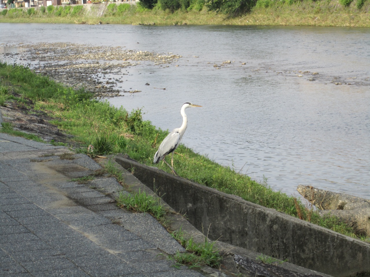
Here is one of the many Heron or Cranes you can see along the river.

This one was a bit timid, but in March and April, they were more aggressive, walking up along the path and not moving out of your way.

There are signs like this all along the river so you can't get lost. Before I had my Garmin, I did interval workouts based on the distances between bridges. This is just before Gojo (mile 3)

This is the Gojo bridge (mile 3) and there are huge trees caught on the bridge. That is how high the water was one week ago. Amazing! Those trees are 6 to 8 inches in diameter!

This is the last part of the paved path. On the eastern side of the river, it is packed dirt for about 2 miles and then paved for the last 1/2 mile. The western side of the river is packed dirt for about a mile and a half, but the path doesn't continue this far south. The bridge you can see there is where the path ends on the eastern side and you have to go back to the western side. You can see a ramp coming down heading north, that is where I will be in about 1/2 mile. (mile 3.5)

The bottom of the steps there is almost exactly 3 miles from my apartment (if you don't cross the river like I did today) making it a no-think route for my 6 mile tempo runs. Today, I am at mile 3.55 or so.

crossing the bridge, you get a great view of Kyoto tower (where the main Kyoto JR station is) (mile 3.6)

heading further south on the western side again. This is about mile 4.
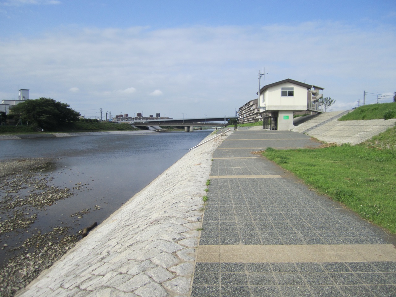
That little "house" is some sort of pumping station and marks the 4 mile turnaround point (if you don't cross the river like I did today). I only went about 1/2 mile further, and the path ends about 3/4 mile beyond here. (mile 4.5)

looking north on the eastern side just south of "the Fen" (mile 7 or so)

a friendly resident

This path is about 1.5 miles south of my apartment, convenient for 3 milers. (mile 7.5)

This is what it looks like looking north about 1.25 mile south of my apartment. There is a little raised bridge (there is a runner on it) that is the one mile mark. (mile 7.75 or so)

This is the 1.25 mile turnaround, handy for short 2-3 mile recovery runs (mile 7.75)

This is what the river looks like looking north (mile 8)

This is where the Kamogawa and takanogawa split. I am standing under the imadegawa bridge (mile 8.9)

Now I'm running north along hte takanogawa. This river is not as pretty as the Kamogawa north of imadegawa which is definitely my favorite route. I'll add pictures of that later this week. Mile 9.1 or so.

Here I'm standing on the bridge where I turned around looking north (mile 9.6)

Now I'm coming south, along a nice sandy dirt path (mile 9.75)

Just past mile 10 on today's run. Looking south along the triangle where the 2 rivers merge. We flew kites here on January 1st with Keiko and her kids.

Here is a map of the river. I have run almost all of this. Some of the southern bridges I don't recognize but maybe I've been down that far. Some of the north eastern bridges I don't know how to get to; the path ends so you probably have to run along the street.
This map is

looking south east; that is imadegawa.

standing at the tip, looking north west. The map is just behind the green sign where the person in white is (that is where I took the previous picture from)

standing at the tip, looking north east.
Such a beautiful running environment. And I will miss it. I won't miss running alone; I have done all of my runs solo for the whole year. But I will miss running along this river.
I can see why you would miss this. Do you see a lot of other runners when you are out?
ReplyDelete